

Washington D.C. Historic Perspectives
Augmented Reality (AR)
Experience platform has been deprecated
Every city, even those that are planned, overwrites itself. Washington D.C., does it more visibly than most.
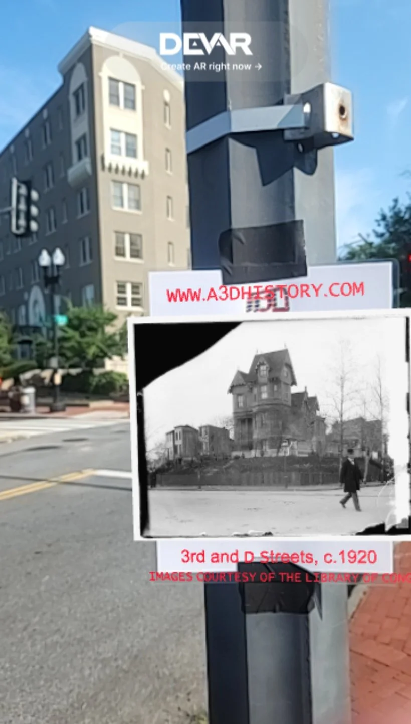
Washington D.C. Historic Perspectives began by asking the question: What if the historical record lived on the street corner where it happened? I wanted this to be a proof-of-concept for augmented reality as public history infrastructure, something closer to street art or a pop-up exhibition: accessible, at the whim of the public around it, and contextualized by local geography.
Plenty of people have done photography projects matching angles and layering historic photography over contemporary streetscapes. I just built upon this idea so that anyone with a mobile device could interact with that comparison, rather than view it second-hand through a web page.
DEVELOPMENT
Washington D.C. Historic Perspectives used web-based AR to eliminate the friction of downloading dedicated applications or making accounts: major points of friction to access. Making the process as simple as a QR scan and image recognition triggers promptly opened the experience directly in a mobile browser. The technical design had to be in line with my philosophy: if the project is about making history public, then access had to be rapid and public.
The experience was created in Niantic’s 8thWall, which has since been deprecated. Like most public art, the QR codes quickly succumbed to the elements or were buried under new street art.
The research for each location draws on a layered archive: period photography, Sanborn fire insurance maps, congressional building records, local histories, and any additional primary sources. However, I intentionally used only photos from the Library of Congress to pilot this experience due to rights and reproductions access. I also chose photos that followed an east-west path (within a few blocks of E Street) in areas with high foot traffic (along the National Mall, Ford’s Theater, Georgetown, etc.).
EXPERIENCE
Overall, I found the experience of accessing the photos and the quality of depth and spatial awareness satisfactory. The existence of just one textured plane and occasionally text assets meant that everything loaded and ran nicely on a mobile device. However, two things are worth considering in similar future projects. Depending on lighting and angles, possible gloss from protective sleeves over the QR codes may make them unreadable to phone cameras. Additionally, QR Code sizing often needs to be individually adjusted to the size of the AR space itself - you need much larger codes to maintain tracking across a panoramic vista versus a tight viewing corridor.

FURTHER STUDY
I think that AR, both tag-based and geospatial, is an interesting technology that is still constrained more by performance and tracking limitations than by possible use cases. It is possible that smart glasses, assisted by prospective “compute pucks,” may have the computing power to handle much more substantial AR rendering and interactions. There is also something to be said about the challenges of publicly accessible forms of entry. Whether it is public art or institutionally maintained public information panels, the physical maintenance of a site may prove a greater challenge than the software itself.